Grassed Waterway
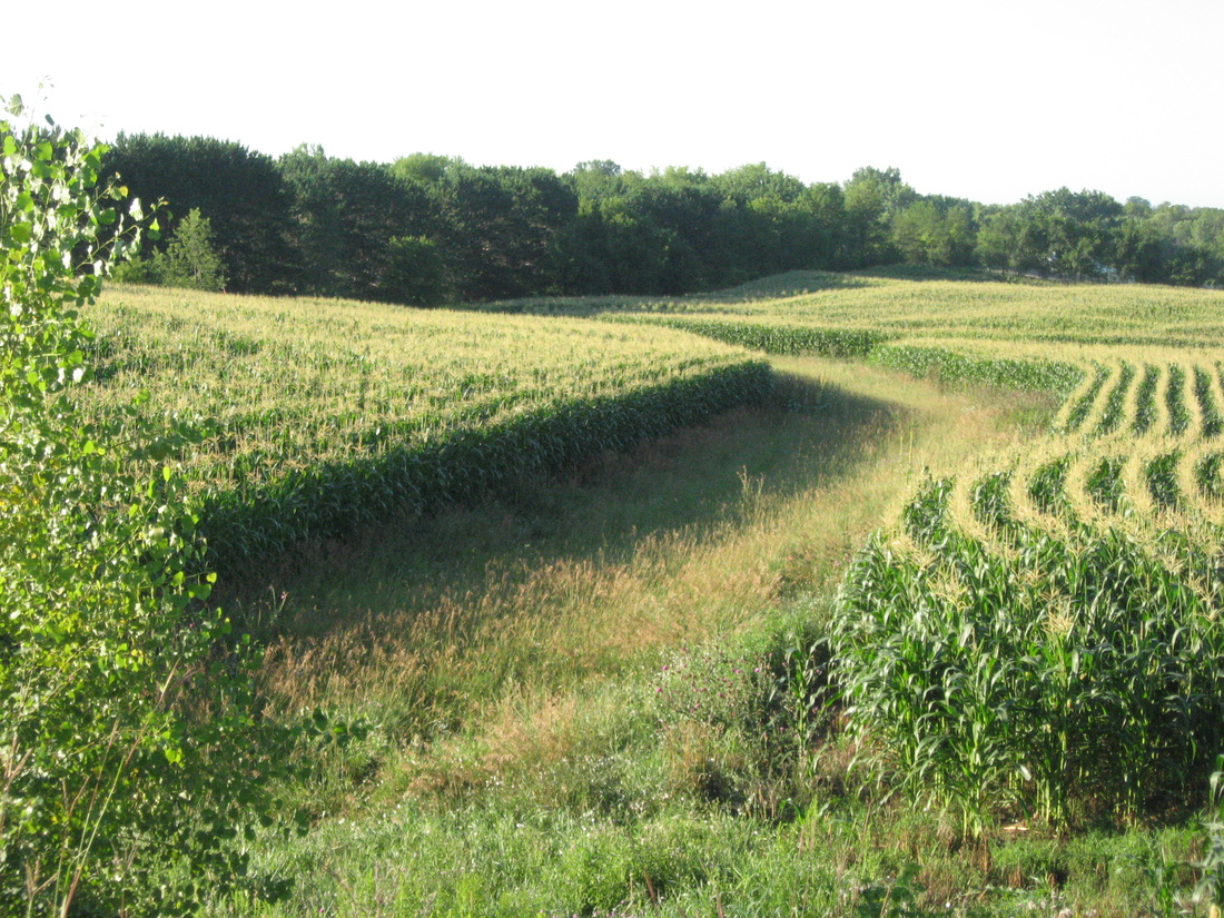
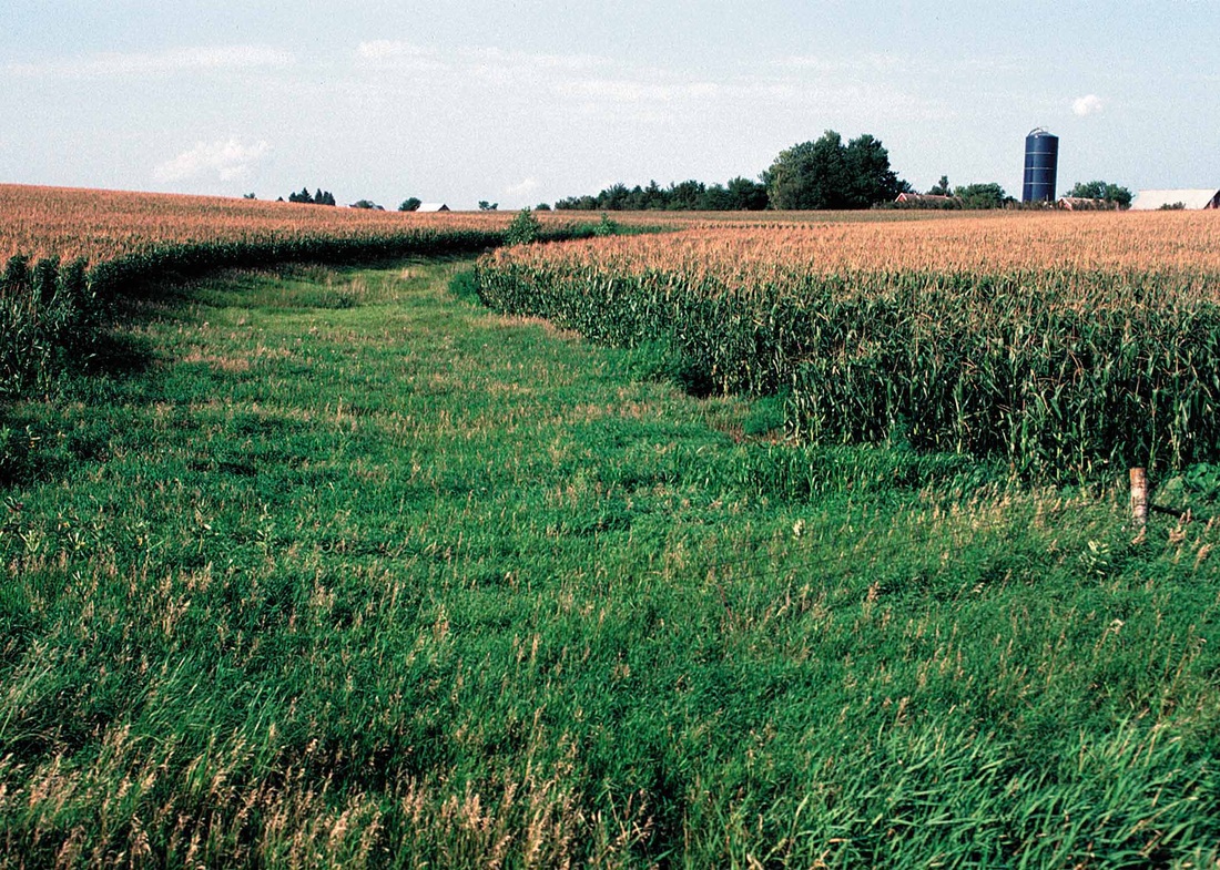
Grass waterways are a type of conservation buffer; they downhill grassed channels, generally broad and shallow, designed to prevent soil erosion while draining runoff water from adjacent cropland. As water travels down the waterway, the grass vegetation prevents erosion that would otherwise result from concentrated flows. Grass waterways also help prevent gully erosion in areas of concentrated flow.
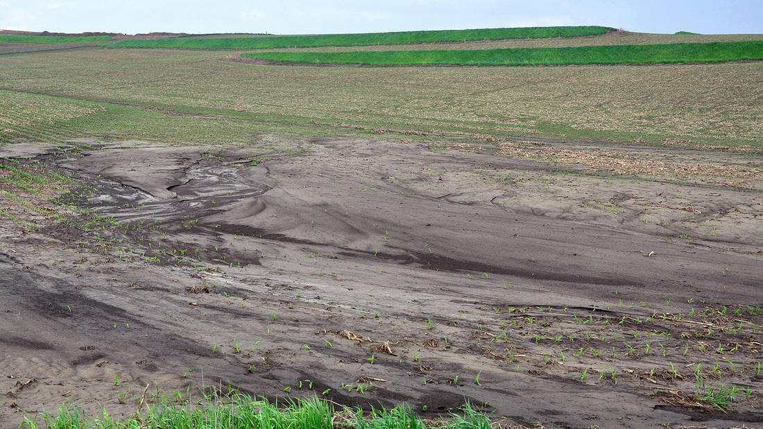
Grass waterways are often used to drain water from areas of concentrated flow around constructed conservation practices such as terraces and runoff water diversions. Grass waterways work best when erosion is controlled on the contributing upland drainage area; otherwise the waterway will become filled with sediment and cease to function properly. In addition to terraces and diversions (mentioned above), examples of upland erosion control practices include contour stripcropping, contour farming, water & sediment control basins, conservation tillage, conservation crop rotation and cover crops. Gully/grade stabilization structures are often installed at grass waterway outlets to prevent gullies from forming there and progressing up the waterway. Grass waterways often adjoin other in-field or edge-of-field conservation buffers such as contour buffer strips, grass filter strips and field borders. Grass waterways of course involve grass planting and ongoing grassland management. A grassed waterway consists in a 2-metre (6.6 ft) to 48-metre-wide (157 ft) native grassland strip of green belt. It is generally installed in the thalweg, the deepest continuous line along a valley or watercourse, of a cultivated dry valley in order to control erosion. A study carried out on a grassed waterway during 8 years in Bavaria showed that it can lead to several other types of positive impacts, e.g. on biodiversity.[1] Confusion between "grassed waterways" and "vegetative filter strips" should be avoided. The latter are generally narrower (only a few metres wide) and rather installed along rivers as well as along or within cultivated fields. However, buffer strip can be a synonym, with shrubs and trees added to the plant component, as does a riparian zone. Runoff generated on cropland during storms or long winter rains concentrates in the thalweg where it can lead to rill or gully erosion. Rills and gullies further concentrate runoff and speed up its transfer, which can worsen damage occurring downstream. This can result in a muddy flood. In this context, a grassed waterway allows increasing soil cohesion and roughness. It also prevents the formation of rills and gullies. Furthermore, it can slow down runoff and allow its re-infiltration during long winter rains. In contrast, its infiltration capacity is generally not sufficient to reinfiltrate runoff produced by heavy spring and summer storms. It can therefore be useful to combine it with extra measures, like the installation of earthen dams across the grassed waterway, in order to buffer runoff temporarily.[2] |
|